


Jade's Quest Greenland Crossing

Dispatches
-
2017-06-07


-
2017-06-05

-
2017-06-03
-
2017-06-02
-
2017-06-01
-
2017-05-31
-
2017-05-30
-
2017-05-29
-
2017-05-28
-
2017-05-27
-
2017-05-26
-
2017-05-25
-
2017-05-25
-
2017-05-23
-
2017-05-22
-
2017-05-21
-
2017-05-21
-
2017-05-20
-
2017-05-19
-
2017-05-18
-
2017-05-17
-
2017-05-16
-
2017-05-15
-
2017-05-14
-
2017-05-14
-
2017-05-13
-
2017-05-12
-
2017-05-11
-
2017-05-10
-
2017-05-10

May 20
#13: more progress
Published at 00:09
At midday the wind began to drop and the sleeting abated so we dug out the sleds and tents and edged 15km closer to the east coast. But the late afternoon brought more wind and squalls and we skied the remaining two hours under a tumultuous sky.
To our surprise a dot appeared on the horizon, exactly on our bearing - Dye II - the decommissioned American military base, one of a string of bases built across the Arctic to detect missiles from Russia during the Cold War era. Still 17km away we should reach it tomorrow afternoon.
Cosy in our tents now with the incessant wind tapping on the walls.
Eric
Pics of Heath using the snow pit as Jade saddles up, shots of the team and Jade and Paul skiing towards distant Dye II.
- Name: Camp 11
- Elevation: 2011 m
- Latitude: 66° 34’ 51” North
- Longitude: 46° 37’ 36” West
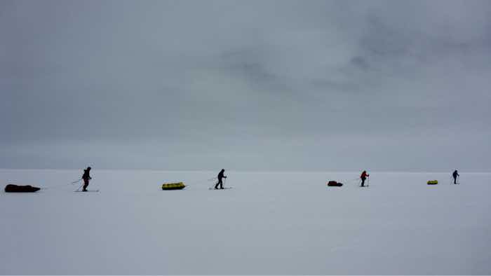
image2
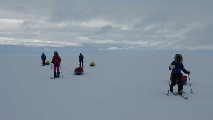
image3
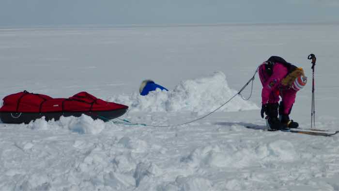
image1
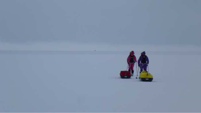
image4
Add Comment


Comments